Operation Nightwatch—field notes from the Marshall Islands EEZ

Operation Nightwatch was a dark-vessel surveillance campaign conducted with the Marshall Islands Marine Resources Authority (MIMRA) to detect vessels operating without identification near the Republic of the Marshall Islands’ Exclusive Economic Zone (EEZ) boundary. The operation combined satellite detections, AIS/VMS data, and airborne verification to help authorities focus patrol assets where the risk of illegal activity was highest. In this field report, Moritz Lehmann shares what the operation looked like from the aircraft and the operations room.
For a concise operational summary, read the Operation Nightwatch case study.
“It’s exciting to find IUU, but it’s also really good to not find it if you’ve been looking really hard.”
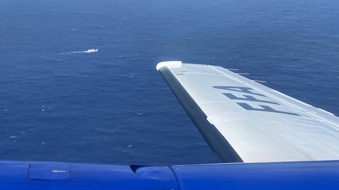
Straining my eyes looking through the window of a King Air surveillance aircraft, I see only clouds and deep blue ocean to the horizon. We left Majuro two hours ago and are on the way to the border of the atoll nation’s EEZ and the high seas. Then I hear the sensor operator talking to the pilot through my headset saying, “target at 2 o’clock”, and immediately feel the plane change its course.
You can see a lot of ocean from 6,000 feet (1,800 m) up. At that altitude, the horizon is about 150 km away and, looking out of the window, I told myself that I was doing an excellent job making sure we didn’t miss any boats down there, at least on my side of the plane. But I still couldn’t see that target. Finally, after much pointing help by the pilot, I saw what the sensor operator had seen much earlier, and I realised how hard it would be to find anything between the whitecaps and cloud shadows.
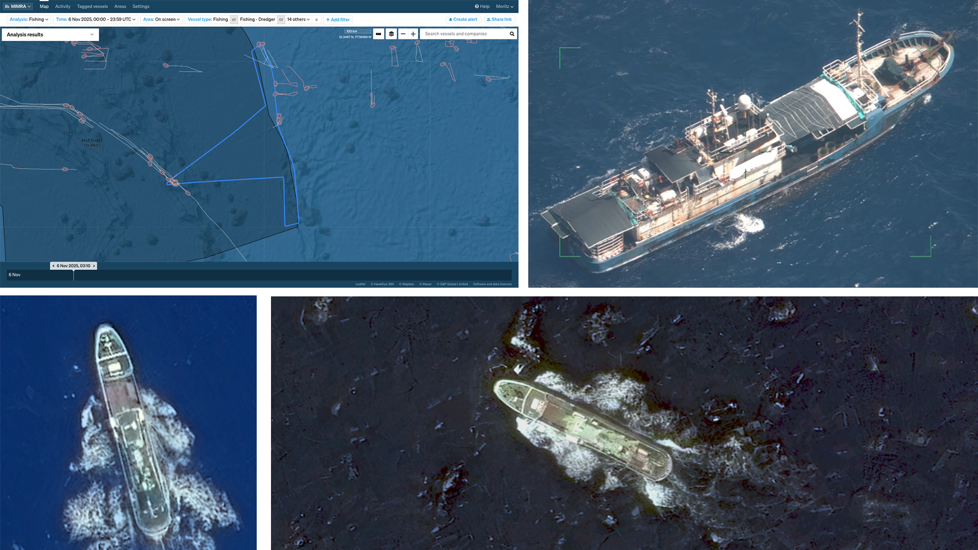
The boat we found was a 50 m longliner flagged to South Korea, fishing on the high seas less than ten miles from the Marshall Islands’ Exclusive Economic Zone (EEZ). Longlining for tuna is a method that uses a mainline, often tens of kilometres long, suspended horizontally in the upper water column by floats, with numerous baited hooks attached via branch lines. The gear is left to soak and drift with the currents and wind for several hours before being hauled. In these waters, the catch consists mostly of yellowfin, albacore, and bigeye.
We found this Korean longliner registered with the regional fisheries management organisation, so it was operating legally on the high seas. We circled the vessel, recorded video of activity and made sure the crew knew we were there, because the vessel was not licensed to fish in the Marshall Islands’ EEZ and, if it were found fishing there, would be breaking the law and subject to heavy fines.
Illegal fishing just inside the invisible border of the EEZ is occasionally observed, and is presumed to happen without detection on a regular basis. However, the EEZ of the Republic of the Marshall Islands is about 2 million km² in size. Sending an aircraft out for a patrol is like trying to cover a flipchart-sized sheet of paper with postage stamps. But we did not come here randomly. We knew where there were ships close to breaking the law by intruding into national waters.
This is the story of how we came to know.
The blue horizon that encircles the Republic of the Marshall Islands (RMI) is the boundary of the nation’s treasury, not merely a spectacular sight. Across two million square kilometres of ocean, the tuna fishery within the exclusive economic zone is arguably RMI’s single most important home-grown revenue source, contributing over one-third of domestic government revenue. This revenue is critically underpinned by selling fishing days to purse seiners and longliners.
Furthermore, Majuro’s transshipment hub is famously described as the world’s busiest tuna transshipment port. It handles hundreds of thousands of tonnes annually. The port creates significant economic spillovers for fuel sales, retail, hospitality, and essential port services, solidifying the fishery’s role as the nation’s economic lifeblood. So, for this nation, the integrity of that fishery is more than a commercial concern. It is a matter of national sovereignty and the economic lifeblood that sustains the atolls. But where the ocean area is two million square kilometres, effective protection against illegal activities is a formidable challenge.
Effective detection of sparse illegal activities in the wide ocean requires knowing who is out there, differentiating normal from suspicious behaviour, and using intelligence to identify high-risk actors. The greatest challenge is the detection of dark vessels, those who violate international law by switching off their AIS or VMS transmitters to hide in the vast ocean with scant chance of being observed and identified.
Satellite remote sensing is one of the only practical technologies capable of regularly monitoring such a vast area. Wide-area synthetic aperture radar (SAR) can detect steel-hulled vessels and is not affected by cloud cover. The ship detection mode of RADARSAT-2 scans strips of up to 450 kilometres width and detects vessels around 30 m length or larger, which show up as bright specks against a dark ocean background. High-resolution optical imagers, while offering around 30 cm pixel resolution for positive identification, have much smaller footprints, demanding highly accurate aiming.
This is where tip-and-cue comes in. Vantor, the satellite provider for our operation, automated a workflow where early-morning SAR detections send coordinates to their optical imager constellation, which then targets the location later that morning. For our task of finding dark vessels along the high seas border, this combined wide-area SAR tipping and high-resolution optical cueing proved to be the most effective way to confirm the presence or absence of potentially illegal fishing vessels inside the RMI EEZ.
I often get excited about the technical challenges of planning the right satellite data collection plan and get a sense of achievement when a nice image is delivered. But this operation in particular required an answer to one critical question: “So what?” What are we going to do with our findings?
Our purpose was not merely to gather data or test technology, but to defend the sovereignty of RMI’s ocean territory with an actionable plan. Since satellite data alone is insufficient for prosecution, eyes-on-vessel verification, using a patrol asset like an aircraft or boat, is essential for identification and confirming illegal activity. Thus, Operation Nightwatch became a tip-and-cue-and-takeoff campaign, where patrol flights were tasked to satellite coverage areas, and morning imaging findings were communicated to the air crew in flight.
Operation Nightwatch leveraged crucial experience from previous campaigns, including the pioneering 2022 Tuvalu dark vessel detection campaign, where we learned that wide-area SAR/RF scans often produce false positives requiring secondary verification. We have also participated in several regional operations run by the Forum Fisheries Agency (FFA), where the operational area covers almost entirely the central western Pacific Ocean. In these operations, patrol assets are not necessarily based in areas where dark vessel detections are likely, and communication with asset operators is limited so that new targeting information cannot always be transmitted in flight. Ultimately, the need for fast, actionable intelligence demanded a unified system that could merge proprietary data like VMS, public AIS vessel positions, and new satellite detections into a single platform for accelerated intelligence work and rapid communication.
To streamline the actual operation, we planned Operation SeaLens. Op SeaLens was the initial phase of the project, designed to develop and fine-tune the advanced satellite tip-and-cue workflow. Its core technical purpose was to test the detectability of target longliner vessels using several SAR satellite platforms and to practice cueing high-resolution optical satellite imagery based solely on SAR detections. We targeted a known fleet of RMI-registered longliners whose location was known to validate the satellite vessel detection efficacy. Crucially, the operation also established strong working relationships and communication channels between the MIMRA, Starboard, FFA, and satellite-provider teams.
Yet, even with cutting-edge satellite technology at its core, the success of the entire operation was built on overcoming seemingly mundane logistical hurdles. Issues such as the necessity of working across three time zones, booking accommodation in a city with only two hotels, and scheduling travel to a remote location served by only two airlines were non-trivial administrative footnotes. They were crucial operational realities that, if not planned for and managed, held the power to endanger and potentially break the entire project.
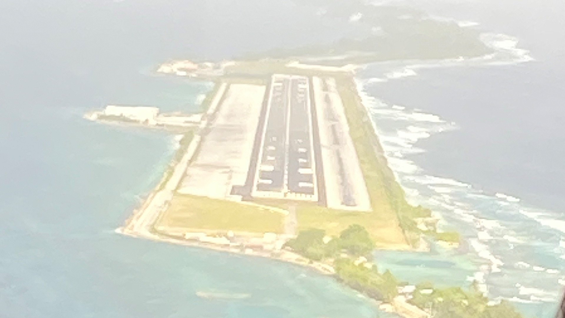
Amata Kabua International Airport, you see, it’s not really an “international” airport in the way Toronto Pearson is. It’s more of a very enthusiastic invitation to an island nation. You step off the plane and the humidity hits you like a warm, wet hug from a very large relative you didn’t know you had. And there you are, right next to the lagoon, right next to the open ocean. It’s a spectacular sight, this little ribbon of coral, so thin that you feel like a particularly aggressive wave could just wash you from the ocean side to the lagoon side.
I was picked up by Melvin, MCS supervisor at MIMRA, and as he drove us to the office he pointed out the wreck in the lagoon and said that this boat was swept there from the ocean side by a particularly aggressive wave in the storm surge of January 2024.
As I explored the atoll, I realised that you can walk across town, perpendicular to the road, before you even finish that first bottle of water. As you meet locals to ask for directions, you find they’re all based on one of two cardinal directions: clockwise, or anticlockwise. And you think, “Well, that’s Majuro,” a place where the landmarks are fleeting, the world is two lanes wide, and the horizon is always blue, blue, blue.
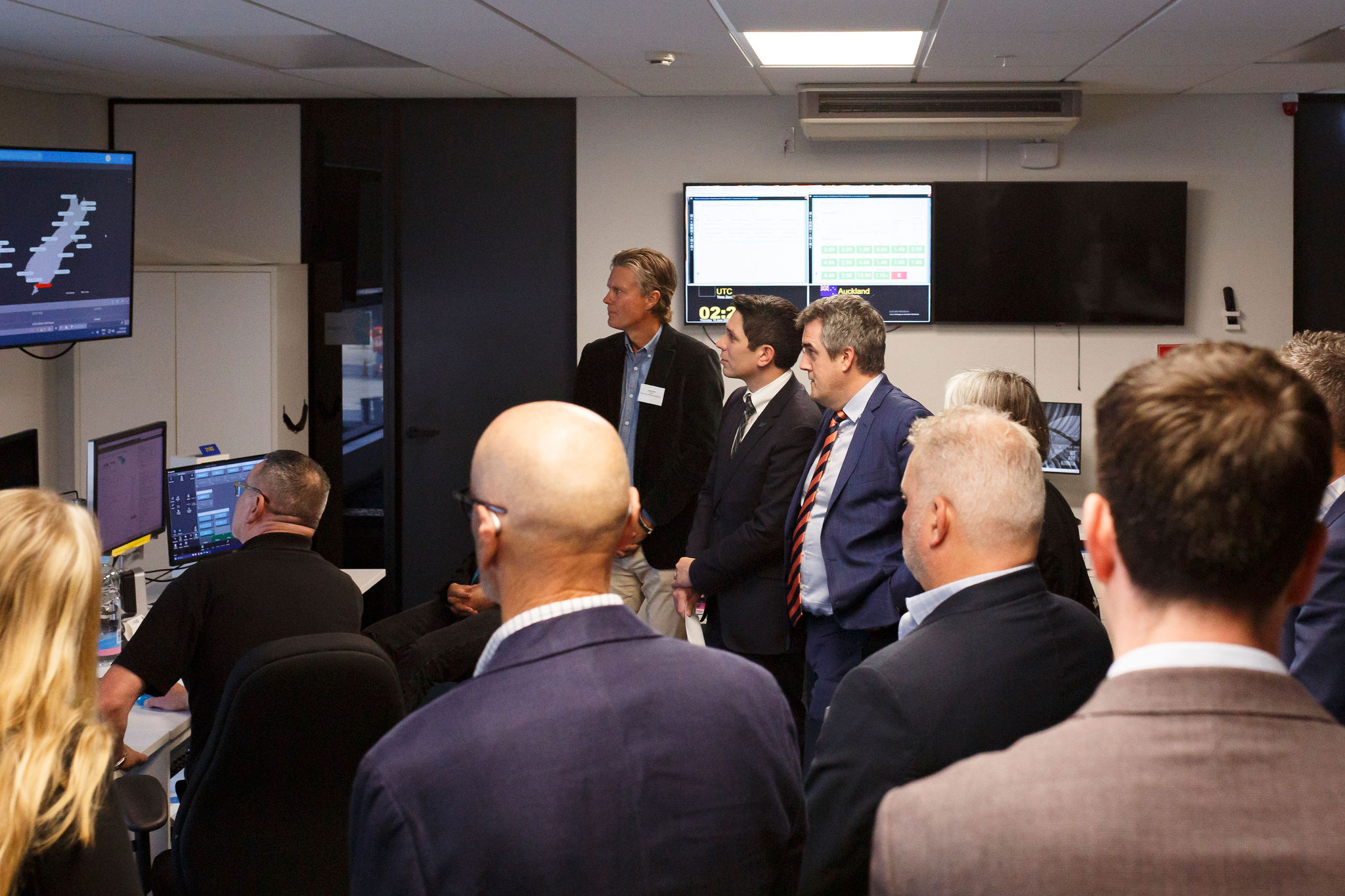
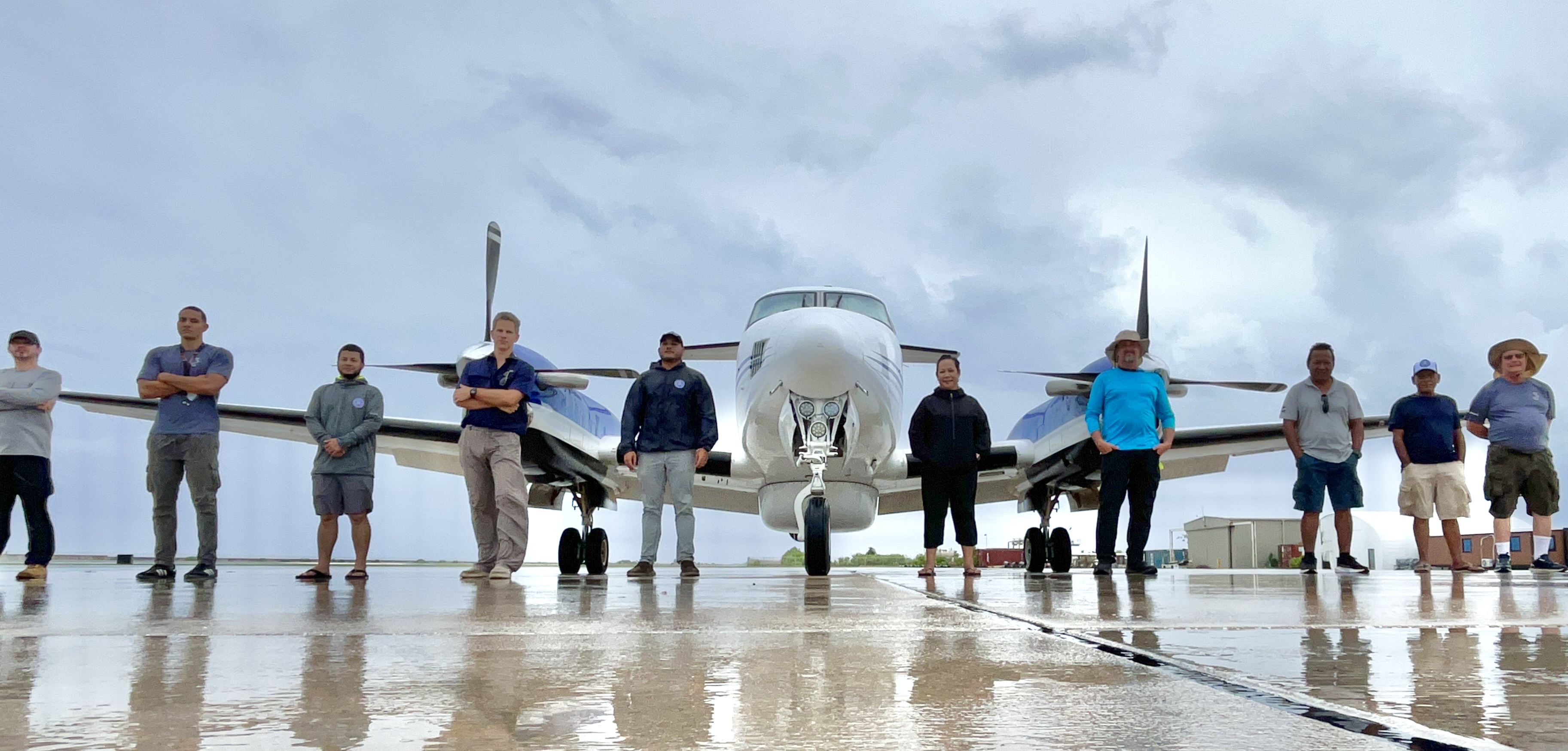
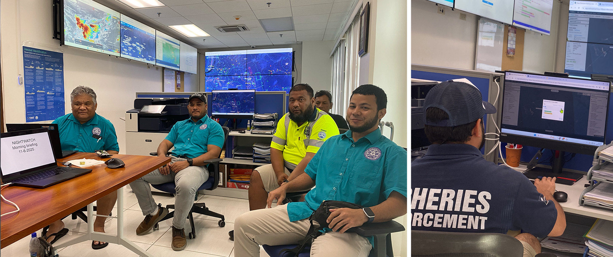
An op day is a rapid sequence of events. Overnight and in the early morning, SAR and RF satellite data is collected, and the team’s first order of duty is reviewing for any potential dark vessel detections. If noteworthy detections are found, an adjustment of the flight plan has to be developed and communicated to the air liaison officer at the FFA in Honiara. Then the airrider, our team member who gets to fly with the aircrew that day, sets out to the airport, clockwise on Majuro’s road.
The rest of the team prepares the situational report (sitrep) with all results from the last 24 hours and planned activities for the day. The sitrep is formally presented at 9:30 during the morning brief, an efficient 20 minutes devoted to getting everyone updated on activities and plans for the day. Since we’re all learning, comments on the format and detail of the sitrep are shared, and the next half hour is spent polishing it as a document of record for the op.
Often, though, it was the hour after the formal brief and before lunch that provided the deepest learnings. One morning, Stevenson, Fisheries Officer in charge of boarding and inspections, looked up from his intelligence report and asked, “Wait, if the plane can see that far, why do we need to spend all that money on satellites?”
It hit me that I had the same doubt. When I was up in the surveillance plane at 6,000 feet, I felt like the master of all the sea because I thought I was seeing it all.
Hand-waving and gesticulating the answer only got us this far, so we looked around the operations room in search of material for a scale model. The largest piece of paper we could find was a flipchart sheet of 59 cm by 84 cm. This flipchart was quickly declared to represent RMI’s EEZ, an area of about 2 million km² in real life.
Now, the sensor operator of the patrol aircraft had told me that a realistic detection range of the optical system is a circle of about 55 km radius. That makes the EEZ about 205 times larger than the area of detection from an aircraft. At the scale of the flipchart, the area of detection is a circle of about 2.5 cm radius, the size of a large postage stamp. Given the range and flight-time limitations of our King Air aircraft, we worked out that each mission could be made up of about 30 stamps.
And when we stamped a few flight paths, the answer to Stevenson’s question was immediately clear. Sending the plane out at random, without prior knowledge of potential dark targets, the chance of coming across an illegal vessel is minuscule, as most of the area is unobserved most of the time.
The satellites, however, give us a full and recurring picture of the risk area to cue the plane, making sure that a postage stamp lands exactly where a dark vessel is most likely to be.
Answering that simple question, exploring the scale and discussing the difference between random patrolling and intelligence-led coverage, taught us to articulate the mission’s core logic in a way the formal brief never could. It was a true “no-such-thing-as-a-stupid-question” moment which led to a conversation that truly cemented the team’s understanding.
And so, after a busy morning of operational planning, the kind of meeting where everyone’s very serious about their sitreps and flight paths, you find that the most important decision of the day isn’t about rogue longliners or satellite orbits, but where to find lunch.
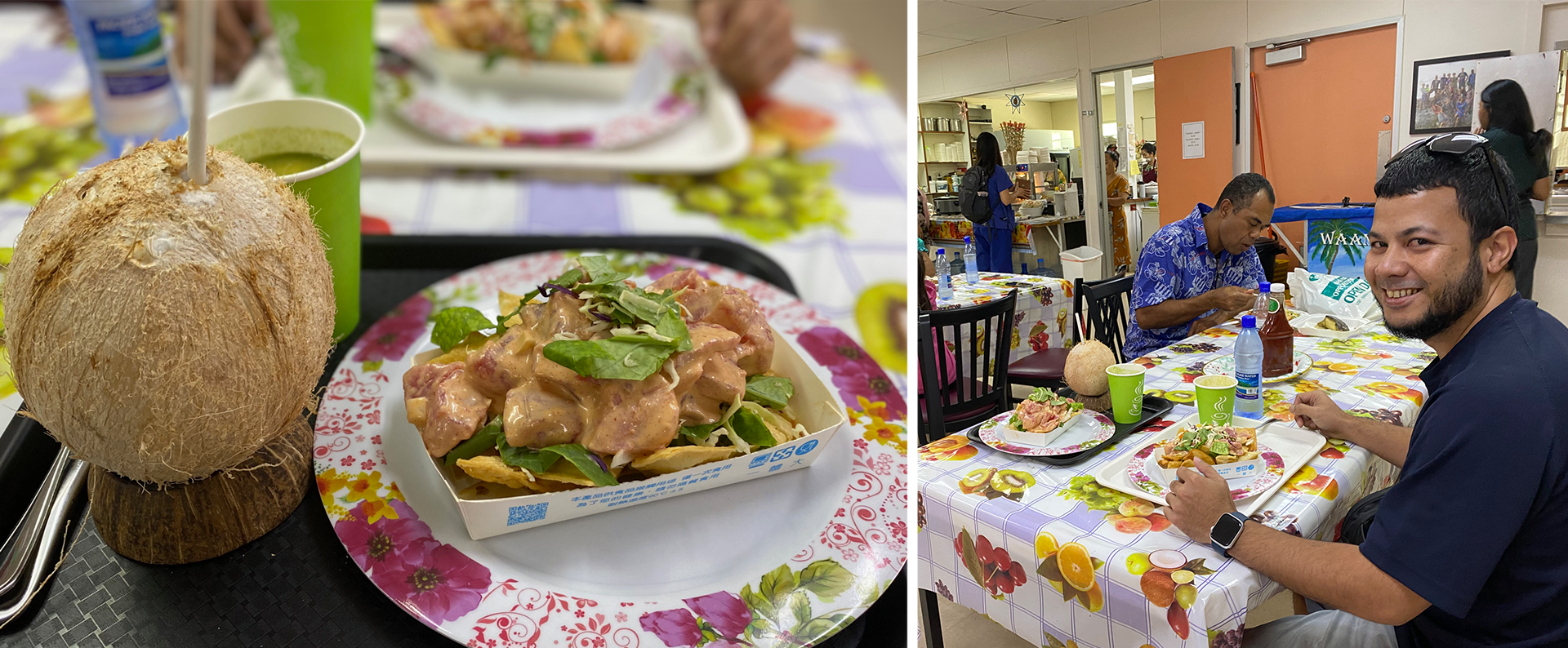
Now, if you’re ever in Majuro, you must understand, a few things are sacred. The tuna, for one, it’s the kind of yellowfin that makes you want to write a sonnet. But then there’s the question of the poke nachos. The folks at the Wellness Centre serve this dish, and I’m telling you, it’s a moment of cultural fusion that could only happen on an atoll a thousand miles from anywhere. It’s got a reputation.
And if you miss out on that, well, you could always chase down the Marshall Islands’ one and only food truck. You don’t need a satellite-supported search for that, because it occupies its patch of coral with the stubborn, geologic permanence of a landmark that has almost forgotten it was once a vehicle. The menu is classic, burgers, fish and chips, but the big secret is, they also do a poke bowl.
It’s a very Majuro kind of choice: you can have the traditional meal, or you can have the traditional meal, but out of a food truck. And either way, you connect with everyone over a plate of the world’s best tuna, which, if you ask me, is a far more effective way to solidify an intelligence-led operation than any morning brief.
On Saturday morning, we received a scan from RADARSAT-2 that included a potential dark vessel detection about 90 km from the planned flight path. Excitedly, we sent a WhatsApp message to the FFA air liaison officer requesting this point be added to the flight plan. The change was approved and, since the detection would be about five hours old by the time the plane reached the spot, a generous search pattern was calculated.
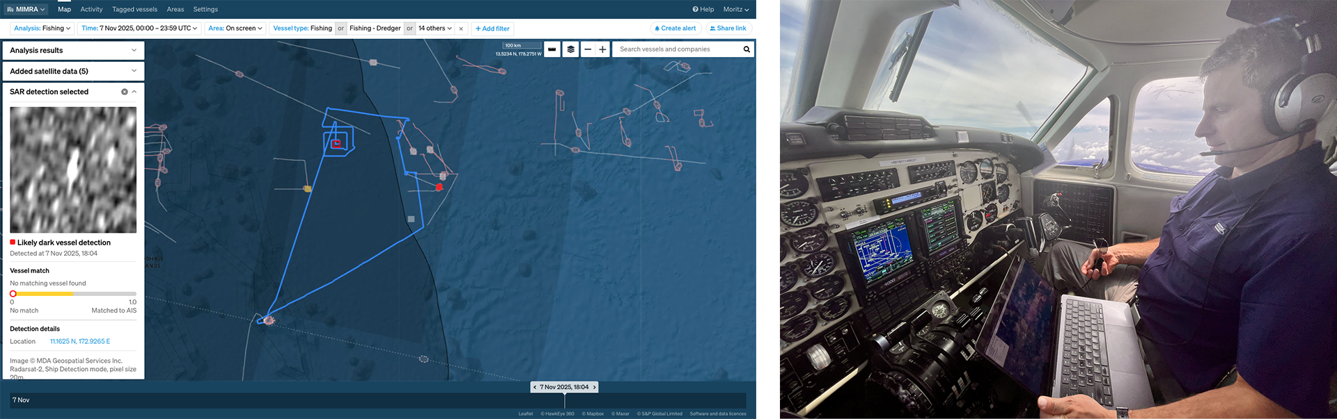
So, we took off in the FFA King Air from Majuro’s Amata Kabua International Airport heading to the point just under 600 km out. Cloud cover was about 70% and haze made it difficult for the eye to search the sea from 6,000 feet (1,800 m), but the camera mounted under the fuselage can use infrared and visible light to search and zoom right into any targets.
After scanning a large area but finding nothing, we aborted the search and continued the planned mission to patrol the border to the high seas to look for any illegal intruders. After flying over four longliners operating on the high seas just outside the EEZ, the copilot announced “bingo fuel”. That meant we had reached the minimum amount of fuel needed to safely return to base, and we flew, as the seagull flies, back to Majuro.
In this case, the dark detection did not turn into a confirmed illegal vessel. But the mission still validated the satellite data, refined our understanding of how quickly targets move, and demonstrated that we could dynamically re-task the aircraft based on new intelligence.
But aircraft reconnaissance was not all we had to look for the potential intruder. The dark vessel detection in SAR automatically triggered programming of Vantor’s constellation of high-resolution optical imagers. These satellites have a pixel resolution of down to 30 cm, generating imagery where you can easily distinguish purse seiners from longliners, open versus closed cargo wells, and any smaller boats around the target vessel.
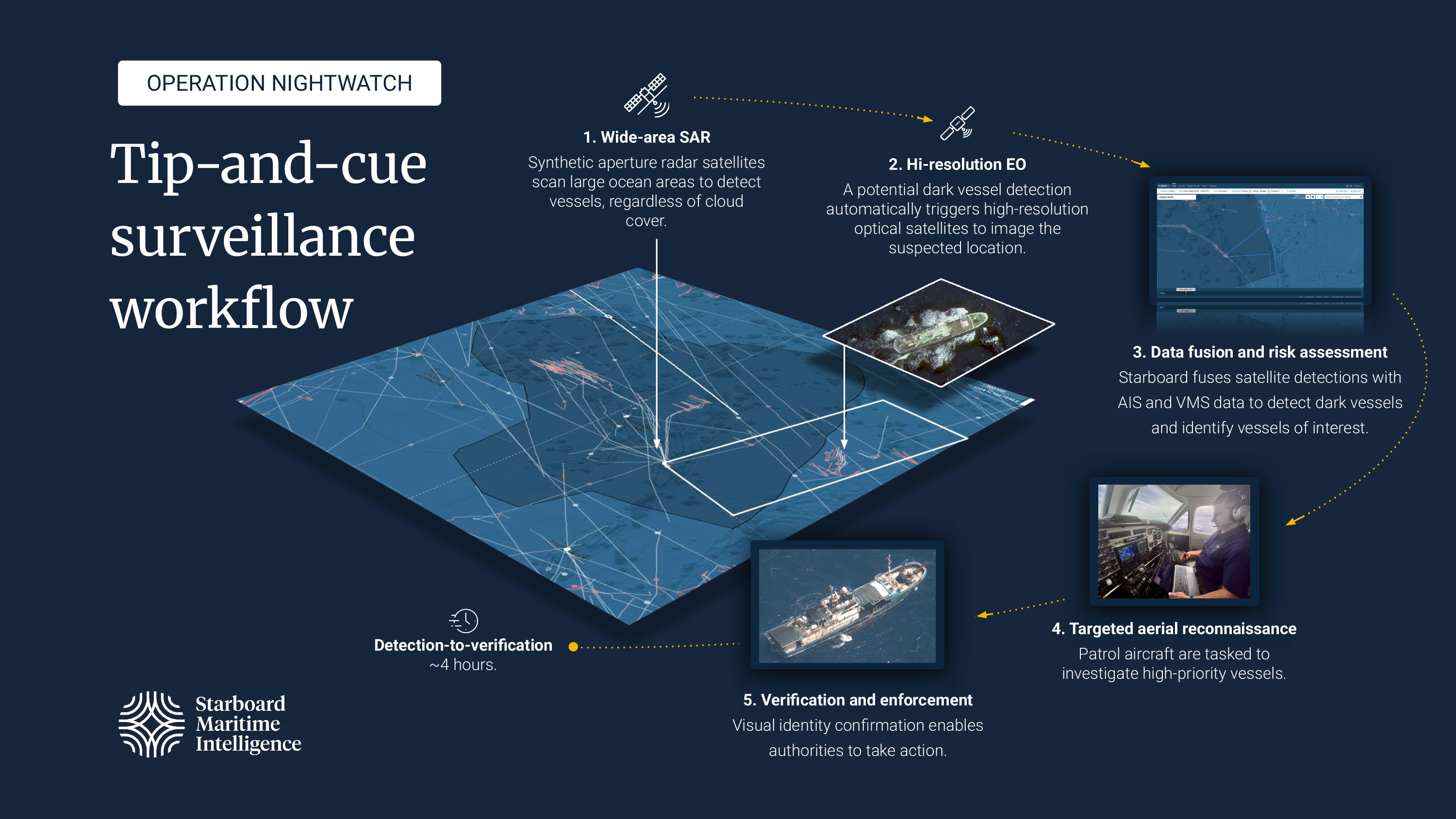
High-resolution satellite imagery typically has the trade-off of a small ground footprint, and rectangles of 5 to 10 km are common for such sensors. Vantor’s satellites can collect areas approximately 60 by 60 km, and they do that by imaging strips side-by-side, each about 15 km wide, in the few seconds that the satellite passes overhead. Moreover, each imaging request goes out to all satellites with opportunities to image that area, and we have often received several sets of imagery from the Legion, WorldView, and GeoEye constellations.
So, come late morning, from about 10:00 local time, several of these satellites will image the area around the target and, cloud cover permitting, any object larger than a few metres across on the water surface will be detected automatically through image processing. About two hours after collection, the image data is delivered to Starboard and automatically displayed in the application. Our system matches any satellite-detected vessels with ship positions known through AIS and VMS, so that potential dark vessels immediately catch our attention.
When we don’t have satellite imagery scheduled, or there are no dark detections to chase, intelligence analysis takes over. We develop a clear picture of who is in and near the RMI EEZ, and which vessels might offend against IUU regulations.
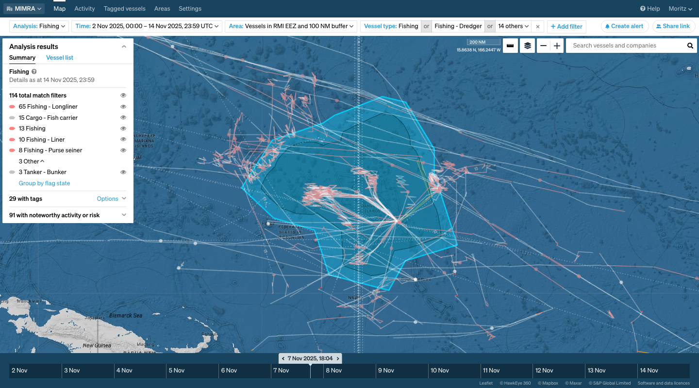
Over 100 fishing vessels and ships that support offshore fishery, such as refrigerated carrier vessels and bunker tankers, operated inside the area of interest: the RMI EEZ and a 100 NM buffer. These vessels were ranked according to the risk of IUU fishing using Starboard’s risk indicator framework. Among the 100 vessels, some had been at sea without port calls for almost a year, had transshipped fish on the high seas, had interactions with officially IUU-listed vessels, and/or transmitted conflicting identity information in their AIS messages. Several had also attracted attention during previous FFA operations.
The Nightwatch team considered all this intelligence to rank vessels in the area and develop a target list for air reconnaissance. So, the default mission of the King Air and crew was to patrol the border to the high seas and to get eyes on high-risk vessels.
The aircraft’s optical payload allows vessel identification and detailed observation of activity on deck. In addition to intelligence gathering for the Nightwatch team, the overflight acts as strategic signalling of enhanced awareness by RMI and should be a deterrent against illegal incursions into national waters.
Operation Nightwatch was a success, not just for the detections and deterrence achieved, but for the proof that MIMRA and its international partners are able to execute a complex, intelligence-led operation by pooling resources and expertise across four different agencies in as many countries. We proved that for a nation where the water area dwarfs the land area roughly 11,000:1, enforcing national sovereignty and protecting the economic lifeblood of the tuna fishery is achievable through the strategic fusion of local knowledge, international expertise, and cutting-edge satellite technology.
During Operation Nightwatch, the combined use of satellite detection, intelligence analysis and airborne verification reduced the time between vessel detection and on-scene inspection from days to only a few hours.
The operation demonstrated a clear methodology—use wide-area satellite sensing for initial detection, use high-resolution optical imagery for positive confirmation, and finally, use air assets for in-person visual verification, identification, and deterrent signalling.
But an operation is more than a sequence of technical steps; it’s an intense immersion in the place you’re protecting. If arriving in Majuro is like a warm, wet hug from a very large relative you didn’t know you had, then leaving is a quiet, thoughtful departure. You step onto the plane, and the air conditioning is suddenly too cold. You look out over the lagoon, that improbable turquoise stretch of water, and the thought hits you: I know what’s out there now.
Before, the blue horizon was just a beautiful, abstract concept of distance. Now, it represents two million square kilometres of national treasury, dotted with known transshipment points, potential IUU high-risk zones, and the ghost trails of vessels that went dark in an attempt to slip past.
You leave Majuro with a feeling of responsibility. You’re leaving the tiny ribbon of land that is the home of the people who depend on that vast, blue ocean. The work remains, but the operational experience, the taste of the poke nachos, the sound of the morning briefing, the distant roar of the King Air taking off on another patrol, solidifies the truth that the most effective enforcement tool isn’t just the satellite or the plane. It’s the determined collaboration of the people committed to protecting the integrity of the Marshall Islands’ oceanic lifeblood.
Operation Nightwatch was supported by World Bank funding and the FFA.
Moritz Lehmann is an oceanographer and remote sensing scientist at Starboard Maritime Intelligence. His work includes satellite detection of dark vessels and supporting maritime surveillance operations, including Operation Nightwatch with the Marshall Islands Marine Resources Authority and earlier projects in the Tasman Sea and New Zealand waters.
Learn more about how Starboard is the common operating picture for the maritime world.